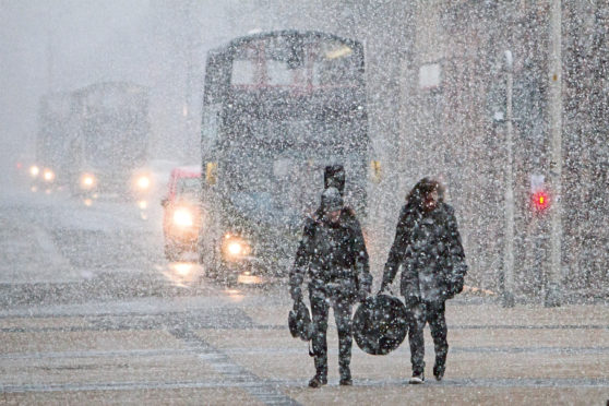
February will howl into Scotland with the heaviest snow of the winter so far, forecasters predict.
According to the Met Office, up to a foot of snow could fall in the north east on Wednesday.
It comes after what was expected to be the coldest night of 2021 last night when the mercury was anticipated to fall below the previous low of -12C seen at Loch Glascarnoch near Ullapool on January 6.
“We are talking about significant falls of snow,” said Simon Partridge, of the Met Office. “The fact that the warning has been issued five days out tells you that confidence is high of disruption to the roads and railways in the area.
“I expect our predictions will be updated many times as we go through the week and we get closer to the day.”
Roads chiefs have told the Met Office that snow is becoming more difficult to clear from carriageways as there are fewer vehicles on the roads due to travel restrictions.
With less traffic, snow has longer to form, without being churned up by tyres.
Orkney and Shetland will continue to see some disruptive snowfall today, after the start of a Met Office yellow warning at 3pm yesterday.
On Tuesday, it is the turn of southern Scotland to prepare for white-out conditions. Heavy rain sweeping up from England will turn to snow as it hits cold air over the Borders. In a 24-hour yellow warning period beginning at midnight tomorrow, as much as eight inches (20cm) could fall over the southern uplands.
The areas affected include south west Scotland, Lothian and Borders, East Ayrshire and South Lanarkshire.
Much of the same area can expect a repeat of heavy snowfall on Wednesday but it’s the forecast for the north east which is causing greatest concern.

Enjoy the convenience of having The Sunday Post delivered as a digital ePaper straight to your smartphone, tablet or computer.
Subscribe for only £5.49 a month and enjoy all the benefits of the printed paper as a digital replica.
Subscribe