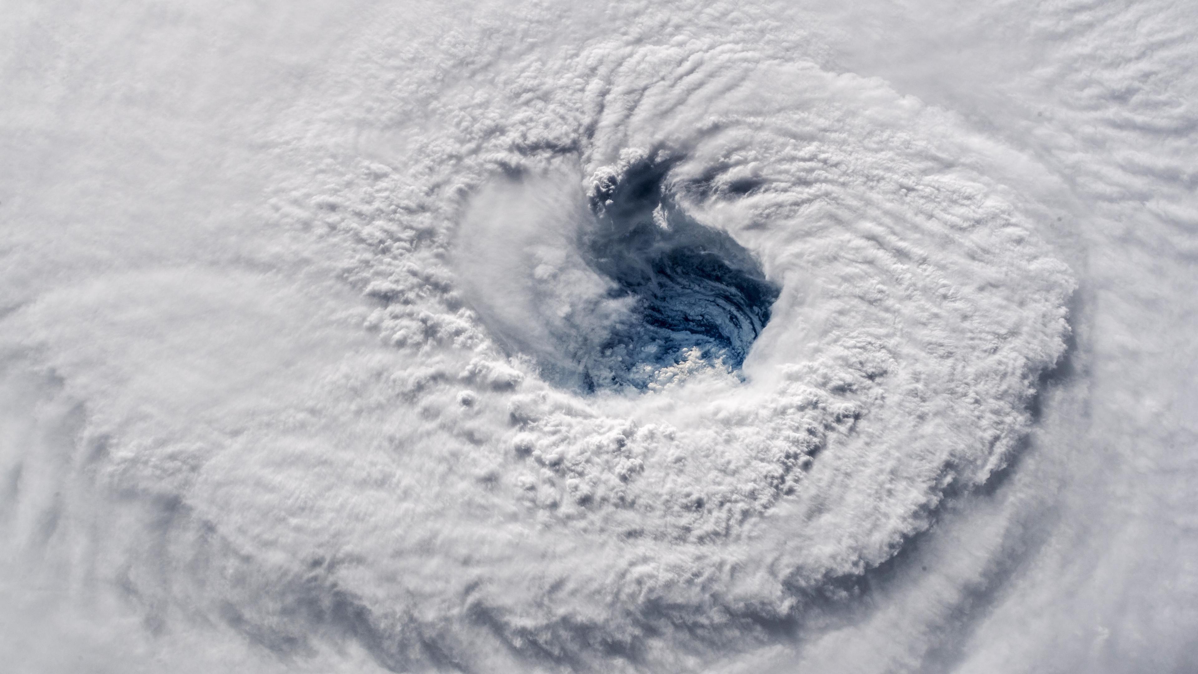
US authorities have warned of “catastrophic” freshwater flooding as Hurricane Florence hits America’s east coast with top sustained winds of 90mph.
Forecasters say the combination of a life-threatening storm surge and the tide will cause normally dry areas near the coast to be flooded by rising waters moving inland.
Storm surge will be a huge factor for Hurricane #Florence Check out what it might look like with @TWCErikaNavarro: pic.twitter.com/TPqTZTmiAM
— The Weather Channel (@weatherchannel) September 13, 2018
Many coastal streets have already been flooded in the Carolinas, despite Florence being downgraded to a Category 1 hurricane.
The Miami-based National Hurricane Centre said in an update at 11pm EDT (4am BST) on Thursday that the storm’s eye was about 50 miles south of Morehead, City, North Carolina.
The core is also about 60 miles east-southeast of Wilmington, North Carolina.
The storm is moving to the northwest at 6mph.
More than 80,000 people were already without power as the storm approached, and more than 12,000 were in shelters.
Another 400 people were in shelters in Virginia, where forecasts were less dire.
“It truly is really about the whole size of this storm,” National Hurricane Centre director Ken Graham said. “The larger and the slower the storm is, the greater the threat and the impact – and we have that.”
As Florence drew near, President Donald Trump tweeted that Fema and first responders are “supplied and ready”, and he disputed the official conclusion that nearly 3,000 people died in Puerto Rico, claiming the figure was a Democratic plot to make him look bad.
Schools and businesses closed as far south as Georgia, airlines cancelled more than 1,500 flights, and coastal towns in the Carolinas were largely emptied out.
Wilmington resident Julie Terrell was plenty concerned after walking to breakfast past a row of shops fortified with boards, sandbags and hurricane shutters.
“On a scale of 1 to 10, I’m probably a 7” in terms of worry, she said. “Because it’s Mother Nature. You can’t predict.”
Forecasters’ European climate model is predicting two trillion to 11 trillion gallons of rain will fall on North Carolina over the next week, according to meteorologist Ryan Maue of weathermodels.com.
That’s enough water to fill the Empire State Building nearly 40,000 times.
Homeless after losing her job at Walmart three months ago, 25-year-old Brittany Jones went to a storm shelter at a high school near Raleigh. She said a hurricane has a way of bringing everyone to the same level.
“It doesn’t matter how much money you have or how many generators you have if you can’t get gas,” she said.
“Whether you have a house or not, when the storm comes it will bring everyone together. A storm can come and wipe your house out overnight.”
Workers are being brought in from the Midwest and Florida to help in the storm’s aftermath, it said.Florence’s weakening as it neared the coast created tension between some who left home and authorities who worried that the storm could still be deadly
.Frustrated after evacuating his beach home for a storm that was later downgraded, retired nurse Frederick Fisher grumbled in the reception of a Wilmington hotel several miles inland.
“Against my better judgment, due to emotionalism, I evacuated,” said Mr Fisher, 74. “I’ve got four cats inside the house. If I can’t get back in a week, after a while they might turn on each other or trash the place.”
Authorities pushed back against any suggestion the storm’s threat was exaggerated.
The police chief of a barrier island in Florence’s bulls’-eye said he was asking for next-of-kin contact information from the few residents who refused to leave.
“I’m not going to put our personnel in harm’s way, especially for people that we’ve already told to evacuate,” Wrightsville Beach Police Chief Dan House said.
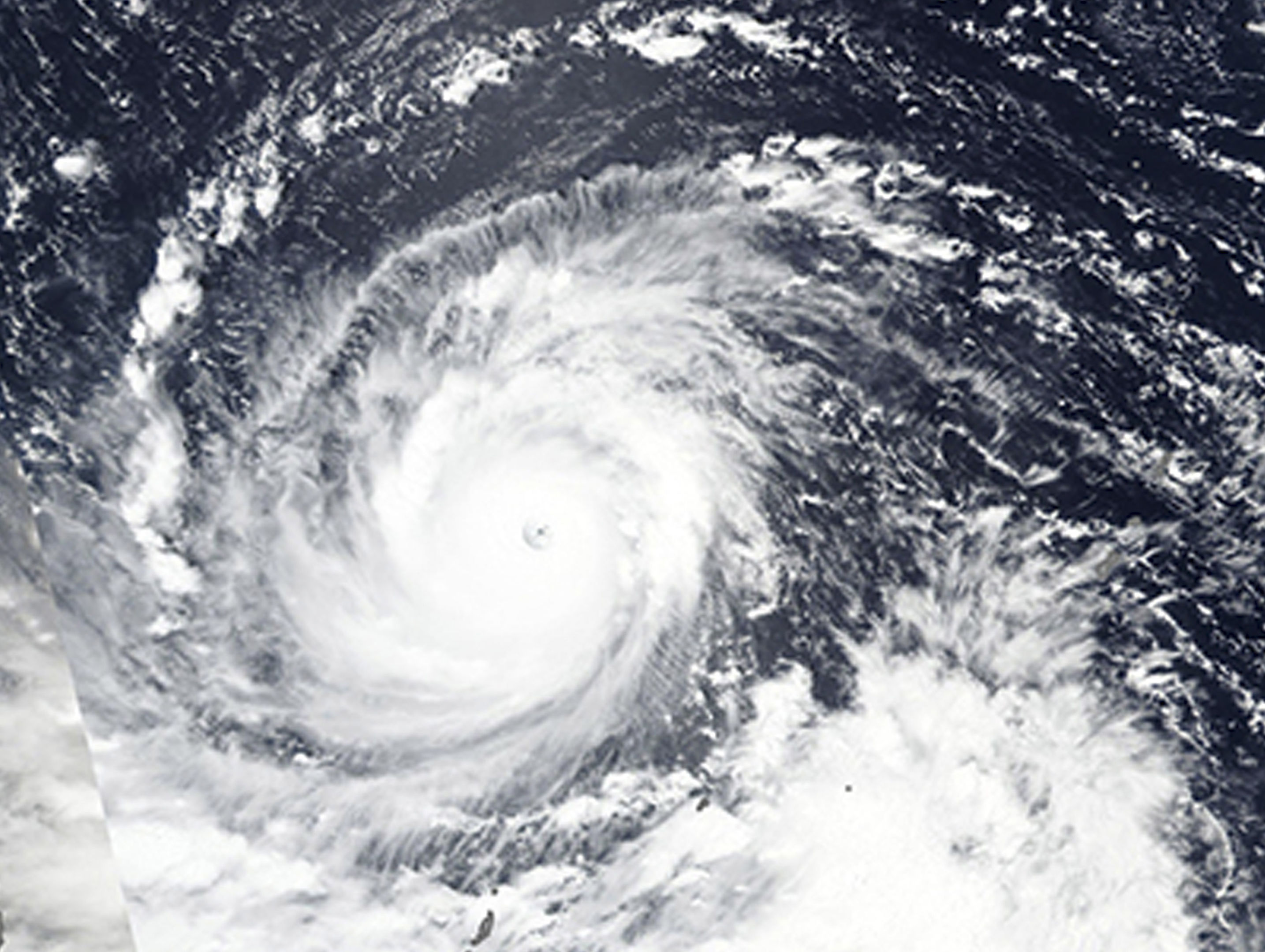
More than four million people live in areas at most risk from the storm, which the Joint Typhoon Warning Centre in Hawaii categorised as a super typhoon with powerful winds and gusts equivalent to a category 5 Atlantic hurricane.
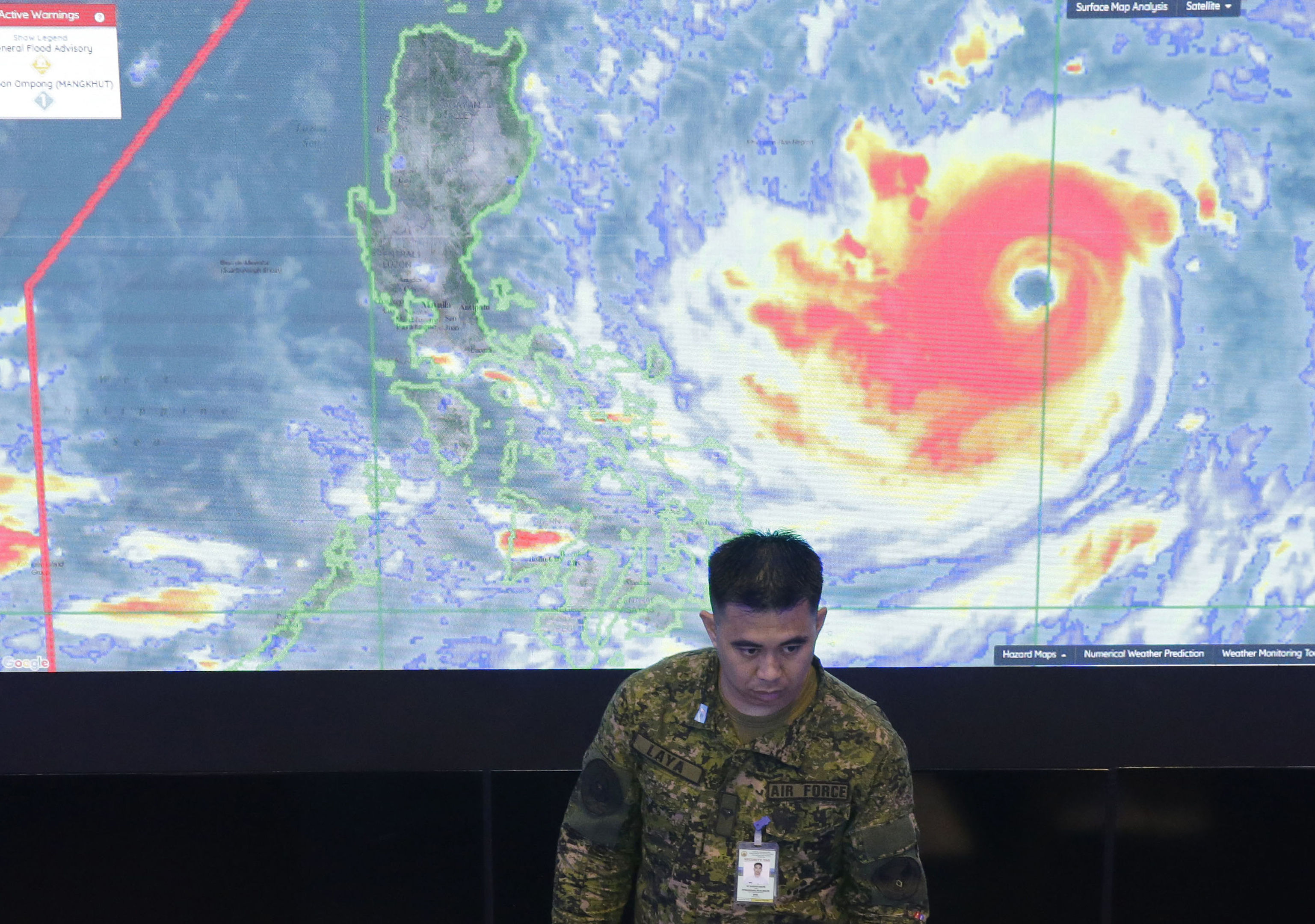
Typhoon Mangkhut is on course to hit north-eastern Cagayan province early on Saturday.
It was tracked on Friday about 250 miles away in the Pacific with sustained winds of 127mph and gusts of up to 158 mph, Philippine forecasters said.
With a massive rain cloud band 560 miles wide, combined with seasonal monsoon rains, the typhoon could bring heavy to intense rains that could set off landslides and flash floods, the forecasters said. Storm warnings have been raised in 25 provinces across the main northern island of Luzon, restricting sea and air travel.
After the Philippines, the Hong Kong Observatory predicts Mangkhut will plow into the Chinese mainland early on Monday morning south of Hong Kong and north of the island province of Hainan.
Though it will weaken from a super typhoon to a severe typhoon, it will still be packing sustained winds of 109mph.

Enjoy the convenience of having The Sunday Post delivered as a digital ePaper straight to your smartphone, tablet or computer.
Subscribe for only £5.49 a month and enjoy all the benefits of the printed paper as a digital replica.
Subscribe


