A WARNING has been issued to be prepared for cold weather as ice and snow are set to continue to hit the country.
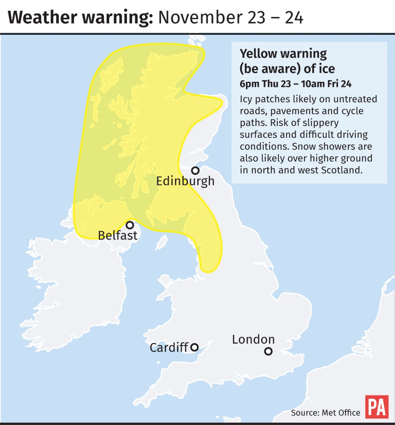
The Met Office has released a yellow warning for ice in parts of the UK over Friday night as temperatures look set to drop.
Snow is predicted to fall overnight, mainly on higher ground, with up to 5cm of snow possible in some areas over 300m.
The weather warning, which is in place from 5pm on Friday to 10am on Saturday, has been issued for Northern Ireland and parts of Scotland and Wales as well as the north of England, Yorkshire and the West Midlands.
Weekend forecast for Scotland
In the west of Scotland, there’ll be rain, sleet and snow showers, mainly focused on Argyll overnight. Temperatures will dip to -2°C.
Most of Lanarkshire and further east towards Edinburgh, Fife and the Borders will stay dry.
In the north of the country, rain, sleet and snow have been falling frequently all day and that will continue into tonight, with temperatures down to -3°C.
Saturday will see a frosty start for most.
In the west, there’ll be some showers, these wintry over the hills and mainly confined to Argyll, but most from Glasgow south and eastwards will stay dry with plenty of weak sunshine.
Further north, showers look set to continue, wintry over the hills and frequent across the north and west where they merge into longer periods of rain, and hill snow at times.
Temperatures across Scotland won’t top 6°C.
Sunday will be much drier and brighter for most of the country.

It will be turning colder for all us over the weekend, with daytime temperatures on a downward trend pic.twitter.com/4e3CZuA0AW
— Met Office (@metoffice) November 23, 2017

Enjoy the convenience of having The Sunday Post delivered as a digital ePaper straight to your smartphone, tablet or computer.
Subscribe for only £5.49 a month and enjoy all the benefits of the printed paper as a digital replica.
Subscribe