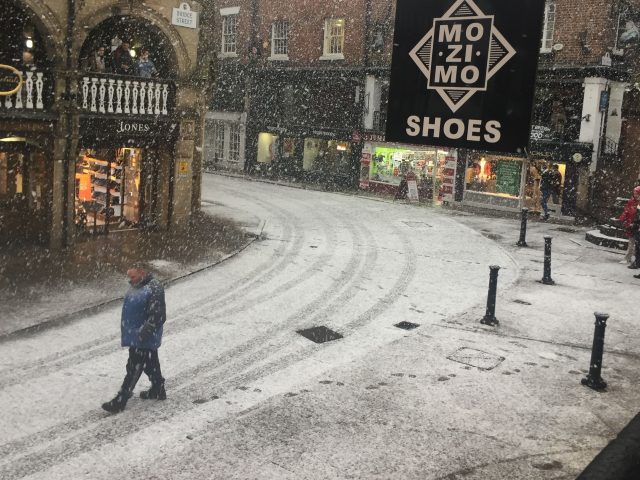
STORM Caroline’s bitter grip on the UK is continuing to be felt by homeowners, school children and commuters, with more snowfall peppering parts of the country.
Forecasters said snow showers will continue to affect parts of Scotland, Northern Ireland, Wales, northern England and the Midlands, with the potential for up to 20cm (8in) of snow as the day progresses.
About 8cm (3.1in) of snow had already fallen in Aviemore, in the Scottish Highlands, by dawn on Friday, while Antrim, Kinmel Bay, Leeds and areas to the west of the Pennines had also had a covering.
Social media users as far south as Birmingham posted videos of blizzards, with the potential for a smattering across the far South West, the whole of Wales and parts of Oxfordshire by dusk on Saturday.
While the white stuff’s arrival was embraced by those seeking to capture picture postcard snowscapes on their cameras, the weather resulted in misery for others – bringing 90mph gales and leaving an Arctic air flow in its wake, which sent temperatures plummeting and shut schools in the Highlands, closed roads and left thousands of homes without power.

Met Office meteorologist John West said: “We saw a fairly consistent stream of snow showers overnight, and there will be a constant feed throughout the day and into Friday.
“We could see some fairly significant accumulations. Broadly speaking we’re looking at 2cm to 5cm, but in more exposed areas we could see 10cm to 20cm.
“It will also be bitterly cold, with highs of 2C or 3C outside those snow showers. But the wind chill is going to make it feel sub-zero.”
Cold temperatures are likely to remain well into next week, with forecasters warning that Sunday could see further heavy snow showers.
The Met Office said icy surfaces are likely to be an additional hazard, especially overnight.
Highways England advised road users intending to travel through the West Midlands and the North West of England to check the forecast and road conditions before they travel, with the threat of disruption throughout the weekend.
The radar sequence shows plenty of showers that have affected many northern and western areas through Friday with most of these falling as sleet or snow. Further snowfall accumulations are expected for some – stay #weatheraware pic.twitter.com/whAJd5a2Sy
— Met Office (@metoffice) December 8, 2017
Council gritting teams are on standby to cover roads across the country, while train services have been suspended, cancelled or delayed, and ferry services faced disruption.
Some 18,000 homes across Scotland have had power cuts due to the weather, according to Scottish and Southern Electricity Networks, with all but 500 restored to service.
The energy company warned its customers to remain prepared for the possibility of further disruption.
Dale Cargill, director of operations, said: “Whilst conditions remain extremely challenging today due to the continued high winds, snow and risk of lightning, our teams are working hard to get the remaining customers back on supply.”

Enjoy the convenience of having The Sunday Post delivered as a digital ePaper straight to your smartphone, tablet or computer.
Subscribe for only £5.49 a month and enjoy all the benefits of the printed paper as a digital replica.
Subscribe