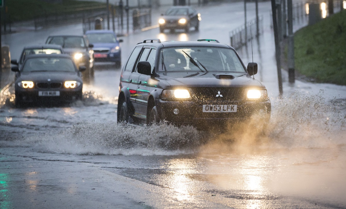
Roads have been closed throughout the North and Scotland as Storm Desmond caused road chaos, landslides and flooding.
The Met Office has issued a Red warning for rainfall, warning those in affected areas to ‘take action to remain safe and protect property’.
RED warning for #rain has been extended to parts of Scotland https://t.co/TmvTfmDfrK #StormDesmond #alert pic.twitter.com/PmM84pjImD
— Met Office (@metoffice) December 5, 2015
Police have cordoned off the area around the Cineworld on Glasgow’s Renfrew Street as debris falls from the roof
Cineworld Glasgow city centre so close pic.twitter.com/c4FDQYLfDc
— Edward cunningham (@Edthemod188) December 5, 2015
Travel around Edinburgh and Fife, already disrupted by yesterday’s closure of the Forth Road Bridge, continues to be busy. A jack-knifed FedEx lorry hit the central reservation on the M8 at Bathgate, West Lothian, closing lanes in both directions. The road has now re-opened.
*UPDATE* ⚠ #M8 (W) J3A Bathgate
Traffic affected by an earlier RTC and is queuing with congestion back to #J4 pic.twitter.com/Yq3elYMA7K— Traffic Scotland (@trafficscotland) December 5, 2015
 The incident on the M8 (Danny Lawson / PA)
A landslide from a hill above Altura, in the Highlands, dumped at least 200 tonnes of debris on the A82 between Spean Bridge and Invergarry overnight. A 15-mile (24km) stretch of the A82 was closed as a result of the landslide and several areas of flooding between Invergloy and Letter Finlay. A geotechnical engineer was dispatched to gauge the safety of commencing a clear-up operation, and traffic was diverted via the A86 and A9. The M90 is also closed between junctions 8 and 9 at Glenfarg. The existing culvert is experiencing a large volume of water flowing from adjacent land, causing the road to flood. Bear Scotland used pumps in an attempt to alleviate the flooding, and traffic was diverted via the A91 and A912.
https://twitter.com/travelclairek/status/673112256465473536The
M9 was closed eastbound from junction 11 at the Keir Roundabout to junction 9 due to flooding.Traffic Scotland received reports of heavy surface water and flooding on A977 on the approach to the Clackmannanshire Bridge at the Gartarry Roundabout.
Trunk road operator Bear Scotland’s team were out throughout the night dealing with numerous issues of flooding, debris on the road and fallen trees across the North West.
There was also flooding on the A85 at Loch Lubhair, south of Crianlarich.
The road was passable with care but the water level of the loch has continued to rise.
The A924 slip road into Pitlochry from the A9 is closed due to the River Tummel bursting its banks.
Motorists have been advised to use alternative routes into Pitlochry.
River levels are rising in Perthshire:
#riverearn #scotland #flooding @WindyWilson88 @PerthandKinross pic.twitter.com/WJFNP3OD6Z
— Party Box Events (@partyboxevents1) December 5, 2015
Several Scottish football matches have also been cancelled including three Scottish Premiership fixtures.
An early pitch inspection at Parkhead resulted in Celtic’s match against Hamilton being called off, while Hearts v Inverness and Partick Thistle v Motherwell have also been postponed.
Rangers’ Championship clash against Raith Rovers in Kirkcaldy and St Mirren’s match against Queen of the South have also been called off. Morton v Hibs was also called off at around 12:40pm, despite the ground staff’s best efforts.
GAME OFF | @Morton_FC v @HibsOfficial has been postponed #LadbrokesChamp
— SPFL (@spfl) December 5, 2015
https://twitter.com/mf6791_mark/status/673064775190974464Train services have also faced disruption due to flooding on the lines. Services to Largs and Ardrossan are terminating at Kilwinning, and services from Glasgow / Edinburgh to Inverness may be delayed or terminated at Perth due to flooding. Flooding between Dalmuir and Clydebank has also affected train services between Glasgow and Milngavie, Dalmuir, Helensburgh and Balloch. Check scotrail.co.uk for the latest.
https://twitter.com/ScotRail/status/673091675414204416Storm
Desmond has also affected the north of England where landslides have caused disruption throughout Cumbria and the Lake District.
A few more photos of flooded river in #keswick #lakedistrict – and still it continues to rain #StormDesmond pic.twitter.com/mry9rm9rhe
— Lee Procter (@theleeprocter) December 5, 2015
Landslide in Red Tarn Beck up #glenridding #StormDesmond @CumbriaWeather @CumbriaCrack @TrailRunningMag @Talkultra pic.twitter.com/XeI8kysVYH
— Mountain Running (@Mountain_Run) December 5, 2015
Highways England issued a Severe Weather Alert for high-sided vehicles, caravans and motorcycles in the North, with an increased risk of vehicles being blown over. The Met Office said: “Be prepared for the likelihood of flooding affecting properties and parts of communities. Watercourses may become dangerous, deep and fast-flowing, while some transport disruption seems likely.” Its chief forecaster warned that the spell of heavy rain and strong winds would be “prolonged”. Forecasters said rainfall of 2.4in to 3.9in (60mm to 100mm) is likely quite widely in the amber zones, with some mountainous areas seeing in excess of 5.9in (150mm) over a 30-hour period, perhaps even reaching 7.9in (200mm). It comes after yellow “be aware” warnings for wind and rain were in place on Friday across much of Scotland, Northern Ireland, the North of England and North Wales. By late Friday, the Scottish Environment Protection Agency (Sepa) had 15 flood alerts in place around the country and multiple flood warnings in Tayside, the Borders and Easter Ross and the Great Glen. South of the border, the Environment Agency has flood warnings and alerts in place in the Midlands, Wales and the North East and North West of England. Marc Becker, hydrology duty manager for Sepa, said on Friday: “Flooding is expected to affect many central and southern parts of Scotland, which could affect communities and cause travel disruption across many areas of Scotland over the coming days. “River levels in the Tay, Clyde and Tweed catchments are already high and are expected to rise considerably in the next 24 hours. “Over the coming days we will continue to monitor levels and update the public on our latest forecasts via social media and Floodline. We would encourage members of the public to remain vigilant and be mindful of the conditions in their locality and when travelling.”

Enjoy the convenience of having The Sunday Post delivered as a digital ePaper straight to your smartphone, tablet or computer.
Subscribe for only £5.49 a month and enjoy all the benefits of the printed paper as a digital replica.
Subscribe